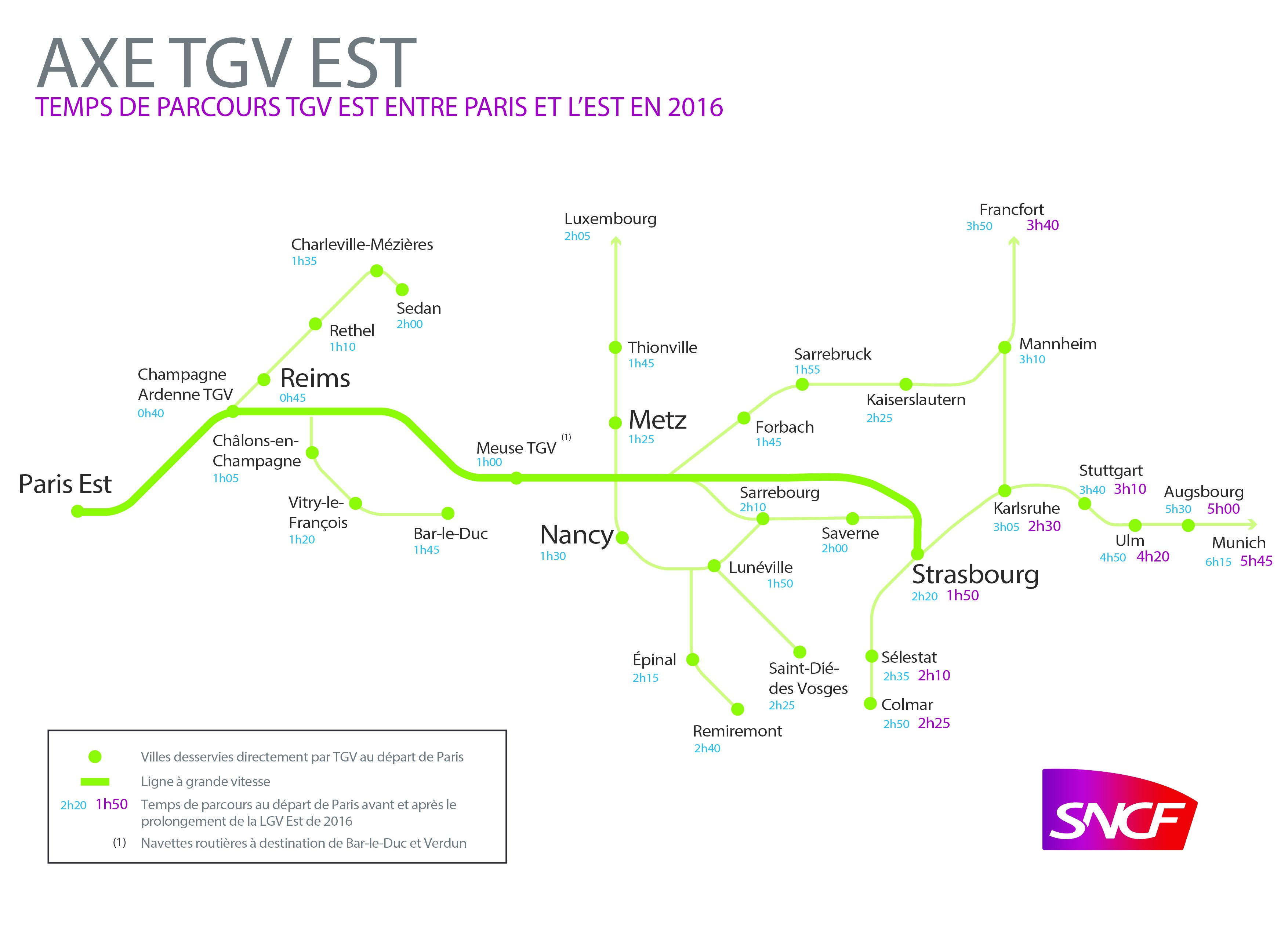
With the opening of the new 106km section of the TGV Est on July 3rd Paris has been conneced to Strasbourg, capital of Alsace, in 1 hour 48 minutes as opposed to 2hr 20 minutes.
As well as faster services to Strasbourg journey times have improved to all services that travel along the line. For example Karlsruhe is just 2 hours 30 minutes from Paris and Frankfurt is 3 hours 35 minutes.
INCREASED FREQUENCIES IN FRANCE
From Paris
The opening of the line has seen an increases in the number of trains operating from Paris to various cities in Eastern France:
16 round trips between Paris and Strasbourg, 4 extended to Colmar
7 round trips between Paris and Reims (five round trips between Paris and Champagne Ardenne TGV with connections to Reims)
10 round trips between Paris and Metz, 6 extended to Luxembourg
10 round trips between Paris and Nancy
From Other French Cities
For passengers who want to avoid changing trains / stations in Paris there are a range of direct connections.
Strasbourg <> Lille – 3 return trips
Strasbourg <> Nantes – 2 return trips
Strasbourg <> Rennes – 1 return trip
Strasbourg <> Bordeaux – 2 return trips
INTERNATIONAL IMPROVEMENTS
Reduced travel times to Germany from Paris
2 hours 29 minutes to Karlsruhe with 7 return trains a day
3 hours 10 minutes to Stuttgart with 4 return trains a day
3 hours 35 minutes to Frankfurt with 6 return trains a day
5 hours 45 minutes to Munich with 1 return train a day
New TGV links from Strasbourg to Luxembourg and Brussels
There are new TGV links connecting the main EU institution cities of Strasbourg, Luxembourg and Brussels:
Strasbourg to Luxembourg has 2 return trips a day taking just 1 hour 36 minutes
Strasbourg to Brussels has 2 return trips a day taking 3 hours 33 minutes

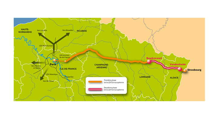 With the opening of the new 106km section of the TGV Est on July 3rd Paris has been conneced to Strasbourg, capital of Alsace, in 1 hour 48 minutes as opposed to 2hr 20 minutes.
As well as faster services to Strasbourg journey times have improved to all services that travel along the line. For example Karlsruhe is just 2 hours 30 minutes from Paris and Frankfurt is 3 hours 35 minutes.
With the opening of the new 106km section of the TGV Est on July 3rd Paris has been conneced to Strasbourg, capital of Alsace, in 1 hour 48 minutes as opposed to 2hr 20 minutes.
As well as faster services to Strasbourg journey times have improved to all services that travel along the line. For example Karlsruhe is just 2 hours 30 minutes from Paris and Frankfurt is 3 hours 35 minutes.